
Photo Editing Software
Onetime(Perpetual License)
About
You can use maps to plan a trip, or just to explore new places.
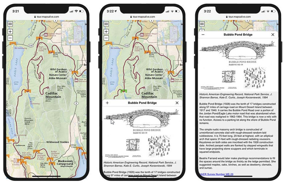
With MapsAlive, you can create an interactive map from any image. This could be a floor plan, diagram, photo, or geographic map. Interactive maps let you move your mouse over markers to quickly see images, text, and video associated with locations on the map. You can use maps to plan a trip or just to explore new places.
Key Features
- ✓ Revision Control
- ✓ Text Tool
- ✓ Remove objects
- ✓ Import from web
- ✓ Enhancement Tools
- ✓ Effects and Filters
- ✓ Collaborative Editing
- ✓ Auto Select
- ✓ Social Media Integration
- ✓ Import-Export Option
- ✓ Built-in Templates
- ✓ Transform tools
- ✓ Batch Editing
- ✓ Cloud Storage
Screenshots
Screenshot 1
Pricing
Basic Plan
USD
49
/Year
- 50 hotspots
- Email support
- Two kinds of interactive maps
- Responsive maps
- Embed interactive maps in web pages
- Mobile app mode
- Zoomable maps
- JavaScript API
- Custom HTML
- CSS
- and JavaScript
- Live Data
- Preview and Publish
- Duplicate a tour
- Step-by-step instructions
- Tour Advisor
- Private tours
- Menu
- Directory
- Display help and information for users
- Slide show
- Hotspot content
- Hotspot markers
- Marker styles
- Marker effects
- Marker actions
- Popup and tiled layouts
- Font and tooltip styles
- Galleries
- Data sheets
- Pop
Plus Plan
USD
99
/Year
- All features from Basic Plan Plus
- Directory and Categories
- Live Data
- Banner option
- Routes
- Import marker shapes
- Replace markers
- Export hotspot content
- All features from Basic Plan Plus
- Directory and Categories
- Live Data
- Banner option
- Routes
- Import marker shapes
- Replace markers
- Export hotspot content
Pro Plan
USD
199
/Year
- All features from Basic plan and Plus Plan Plus
- Archive tours
- Duplicate tours
- Private tours
- Import routes
- All features from Basic plan and Plus Plan Plus
- Archive tours
- Duplicate tours
- Private tours
- Import routes
User Reviews
+ Write a Review
No reviews yet. Be the first to review!
Frequently Asked Questions
How much does MapsAlive cost?
▼
MapsAlive offers 3 pricing plan(s):
- Basic Plan — USD49.00 /Year
- Plus Plan — USD99.00 /Year
- Pro Plan — USD199.00 /Year
What is MapsAlive used for?
▼
MapsAlive is a Photo Editing Software solution. Top features include:
- Revision Control
- Text Tool
- Remove objects
- Import from web
- Enhancement Tools
Does MapsAlive offer a free trial?
▼
Yes, MapsAlive offers a 0-day free trial.
What support does MapsAlive provide?
▼
MapsAlive provides Online (Ticket) support.
Is MapsAlive cloud-based or on-premise?
▼
MapsAlive is Cloud Hosted software.
What training resources does MapsAlive offer?
▼
MapsAlive provides Help Guides,Blogs for training.


